I HAVE CLOSED DOWN THIS BLOG. Please click the photo above to be REDIRECTED TO MY NEW (continuation) BLOG.
Showing posts with label Malham. Show all posts

Saturday, 19 October 2019

Top and bottom


There's a glorious view from the top of Malham Cove, down to Malham village and way beyond. You can perhaps just see the distinctive whale-back of Pendle Hill on the horizon to the right. That's in Lancashire! The wiggly white line in the photo is the footpath that leads from the cove to the village, surfaced with limestone chippings to prevent erosion from the feet of the thousands of visitors who come to see this magnificent landscape.

There is a limestone pavement at the top of the cove, great blocks of limestone clints dissected by deep fissures known as grikes. There are some unusual plants that grow in the clefts. My young friend hopped nimbly over the treacherous rocky surface. Me... I went the long way round across the fields at the back! But I still had to brave the long, steep staircase cut into the rock down from the top to the base of the cove. It makes my thigh muscles tremble! Worth it though, for the view you get back up to the curved limestone cliff, 300m wide and 80m high, formed by glacial meltwater in the last Ice Age. It always reminds me of a theatre auditorium. These days the water seeps out from the base of the rock. On very, very rare occasions (like the floods of winter 2015), a waterfall does still cascade over the lip. See HERE for spectacular footage of that event.


Friday, 18 October 2019

Janet's Foss and Gordale Scar


I'm blessed with really good neighbours on both sides at the moment, a young couple on the one hand and a young man on the other. The generational divide isn't a problem and they are all friendly and extremely helpful. The young man is about to start a new job and was having a couple of weeks off so he asked me if I'd like to take a walk with him one day. He is from down south, has no car and doesn't know the Dales all that well, so it's rather enjoyable to introduce him to new places. We decided to go to Malham. It was mid-week so I knew it would only be busy and not as super-crowded as it tends to be at weekends and bank holidays. It was a reasonable day too, dry and warmish, if rather dull. We did the classic walk: up the gorge past the waterfall known as Janet's Foss, further up to have a look at Gordale Scar and then back and over to Malham Cove.

There was a fair bit of water coming over the falls, though I'm sure there is more now, as we've had a lot of recent rain. It's a charming spot in a wooded valley. You can quite believe the legend that the Queen of the Fairies lives in a cave behind the waterfall.


Beyond the falls it's another half mile or so walk up to Gordale Scar, a deep ravine that was probably formed by glacial meltwater or an underground cavern collapsing. It's hard to convey its scale in a photograph. The limestone cliffs are over 100m high and a stream comes crashing over the rocks in a series of waterfalls. The couple in the foreground of my photo were about to climb the cliffs. We watched the girl climb nimbly and fast, right up to the steepest overhang. I did take a picture of her up there but unfortunately she was wearing clothing that camouflaged her against the rock face, so you really can't see her. (All climbers should, by law, have to wear red!!)


The stream bed is notable for its deposits of tufa, an unusual rock formed by the water depositing calcium carbonate.


It is possible to climb up alongside the waterfalls and continue on up the gorge to Malham Tarn, the lake that lies above, though it is a steep and nerve-wracking scramble. (I have done it once - never again!) Instead, we retraced our steps down the ravine and then took the footpath that climbs steeply over the fields towards Malham Cove.

Thursday, 7 June 2018

Malham Cove


In my pictures yesterday, the spot where we were sitting taking in the view was roughly in the middle and top of the photo above. The photo shows Malham Cove, the enormous curved limestone cliff formed by a waterfall carrying glacial meltwater in the last Ice Age, more than 12000 years ago. Nowadays the water sinks into the limestone and is carried underground until it trickles out at the base of the cliff. 

Walking across the top of the Cove needs care, a clear head and careful foot placement, since it is a limestone pavement with huge slabs of rock (clints) separated by deep fissures called grikes. It's a fascinating karst landscape and there are often school parties exploring the unusual formation as part of their geography studies. Once across the pavement there is a long, steep, stone staircase (to the left of the Cove in my photo). By the time we reached the bottom and the level path, my legs were trembling! It was as good as a workout at the gym. 

The Cove is a mecca for rock climbers, though I didn't notice any the day we were there. Some of the climbing routes have to be closed to allow the nesting peregrines to raise their chicks in peace.


The walk back to Malham village is gently undulating and peaceful, with far-reaching views down the valley and back up to the Cove. We sat for a while with a drink outside one of the village tea shops (of which there are several, and several pubs too). It was a really lovely day out, and we walked a good 5 miles, though it felt even longer as it is such an up and down route. It is a justifiably famous circular walk. What a privilege to have such scenery within an hour's drive of home.

Wednesday, 6 June 2018

A walk round Malham


A friend and I decided one day to do the 'classic' walk from the Yorkshire Dales village of Malham up to Gordale Scar and then over to Malham Cove, before heading back to the village. It's a beautiful walk but very popular. Malhamdale is an area best avoided at weekends and holiday times. This was midweek and not the school holidays but even so the large car park in Malham was full and we had difficulty finding somewhere safe to park. Once we set off to walk though, the route wasn't crowded. Maybe everyone else was in the coffee shops?

Initially, it's a very pleasant amble from the village on a good path alongside a stream, through meadows twinkling with buttercups. You then enter a wooded valley, which was sun-dappled and fragrant from wild garlic. It had rather a magical feel.


The path arrives at a waterfall called Janet's Foss, which pours into a clear, circular pool. It's like a fairy glen, very pretty. In fact the name Janet, or Jennet, is said to refer to a fairy queen believed to inhabit a cave behind the waterfall. There wasn't a lot of water coming over the cascade, as May has been a very dry month. (All the little spots in the photo, bottom left, are tiny flies dancing in clouds above the water.)


Climbing up past the falls, the path widens out again for a short while, up a rocky valley towards limestone cliffs that narrow into a gorge that may have been gouged by glacial meltwater or the collapse of an underground cavern. Another waterfall (also very meagre that day) tumbles over a rocky outcrop known as Gordale Scar. It looks nothing in my photo, though you can get some idea of the scale if you spot the small figure above the ribbon of water tumbling over the rocks at the base. I once climbed up that first outcrop into the upper chamber (where there is a much bigger waterfall)  and it is steep, treacherous and terrifying! Never again!


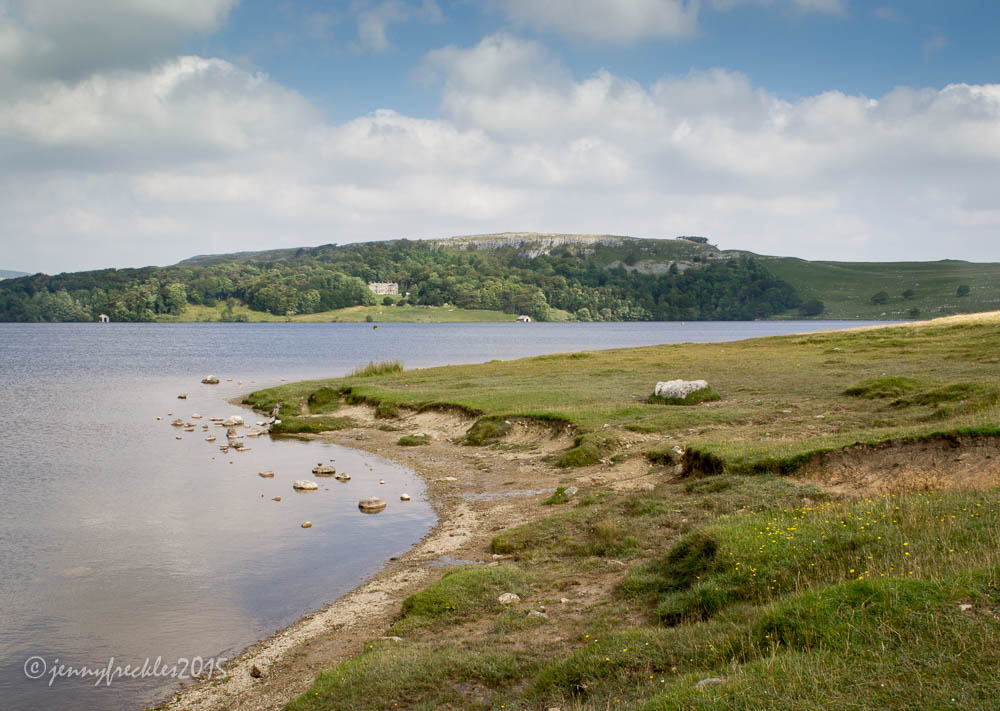
Thankfully, by retracing one's steps about half a mile back down the valley, there is another path that climbs up and over the hillside to eventually arrive above Malham Cove. The Cove is one of the most spectacular features of the Craven Fault, an important geological feature across the Pennines, which defines the boundary between the limestone uplands to the north and the gentler pastures to the south and west. The views down to Malham village and beyond are beautiful. The limestone areas of the Yorkshire Dales are so attractive on a sunny day. Blue sky, verdant green foliage and the pale stone outcrops and walls make a very harmonious scene.


We sat for a while above Malham Cove, trying to spot the peregrine falcons that nest there every year, but we couldn't see them. Sometimes at weekends the RSPB set up telescopes below the Cove so that people can view the nest and the birds. It's rather exciting as peregrines are not all that common in the UK.


In the photo below, the winding white ribbon is the gravel path that leads back to Malham village, which we walked down later when we'd descended the steps beside the Cove. You can see the steps in the photo above, far side. It makes them look like a gentle slope, but in fact they are massively steep and long, rather knee-trembling!


Monday, 7 December 2015

A little extra excitement...

Northern England had very heavy rain over the past weekend, 13.4 inches (341.4mm) in 24 hours. Many areas to the west of here, Carlisle and the Lake District in Cumbria in particular, have suffered appalling flooding and destruction, despite millions of £s being spent on flood defences in recent years. In fact two of the largest Lakes (Derwentwater and Bassenthwaite) actually became one, leaving much of the town of Keswick, which sits in between, under several feet of water. However, there has been a lighter side... You remember my picture of Malham Cove I posted a few weeks ago..? Well, for the first time in living memory it became a waterfall on Sunday. Normally the water disappears underground through limestone tunnels and caverns and comes out in a stream at the bottom of the rock but there was so much rain that the water overflowed over the top.  Click here to see some amazing photos and video.

Tuesday, 27 October 2015

Dog tired at the Smithy


This sleepy labrador made me laugh! It was (rather uncomfortably) lying out in the sunshine on the cobbles outside Malham Smithy, in the centre of the village. These days the Malham blacksmith is Annabelle Bradley, who uses traditional techniques and contemporary designs to produce decorative items for the home and garden.


Monday, 26 October 2015

Malham


Malham village itself is a few miles south from the Tarn and below Malham Cove. There has been a settlement here since the Iron Age and in the 18th and 19th centuries it was a busy centre for mining and mills. Nowadays a few hill farms and tourism are the main activities - and it really is a tourist hotspot (especially since it featured as a location in one of the Harry Potter films). The limestone provides climbing and potholing opportunities and there are numerous beautiful walks around the area, to the spectacular Cove itself and to the local waterfalls and gorges. Bed and breakfast places abound and there are several good pubs - essential to cater for all those thirsty hikers!


Sunday, 25 October 2015

Malham Cove


I was sure I had a photo of Malham Cove on my blog. I didn't go walking up to it on this trip, as I've been so many times. But I can't find a blog post about it so I must have dreamed that. I have, however, managed to locate an earlier photo I took (May 2007!).  It shows the cove and a group of birdwatchers. Peregrine falcons nest and breed on the face of the cove. They are relatively rare and endangered but wonderful birds to watch, so the RSPB sets up an observation post to monitor their breeding progress over the summer months. Volunteers are on hand to help people look through telescopes and see the birds.  See here.

The photo doesn't really convey the sheer size of the cove, which sweeps round in a big arc. There's a wonderful area of limestone pavement at the top (if you can face the climb; there are steps... hundreds) and at the bottom a small stream bubbles up from the base of the rock, flowing out from the labyrinth of tunnels and caverns that make up limestone country.

Saturday, 24 October 2015

Smelt mill chimney


These days, the fells of the Yorkshire Dales seem vast, open and sparsely populated, home only to sheep and curlews. It makes them very attractive to walkers and photographers. Indeed, the Pennine Way long-distance footpath skirts Malham Tarn. But - in plain sight, as it were - the history of the area is there to be read. You might think this pile of stones is some sort of cairn, like those you often see placed by walkers beside mountain paths. In fact it is a mill chimney. Lead, copper and other minerals were mined in the area during the 18th century. The metal ore was crushed and then processed in a smelt mill. A long flue led from the mill to this chimney, where the toxic fumes were dispersed.  The 'feel' of the area must have been vastly different in those days.

Friday, 23 October 2015

Tarn Moss and Tarn Fen


Part of the terrain around Malham Tarn is extremely unusual. The area as a whole is underpinned by limestone and the lake itself is an uncommon marl (alkaline) lake. An area of fen and bog has developed since the last ice-age over a shallow area of the lake, gradually building up a dome of acid peat bog, now 10m thick in parts, that allows rare acid-loving plants and mosses to grow. It became a National Nature Reserve in 1992 and is now carefully managed to provide the right balance to support and nurture the plants, birds and other wildlife. Such bogs are an especially valuable resource as they store carbon that would otherwise contribute to global warming.


There are deer in the reserve and for a moment I thought I saw one... or perhaps a leopard? ... but no, just a piece of wood.


Thursday, 22 October 2015

Survivors


I rather liked the windblown shapes of these trees on the edge of Malham Tarn. It can be rather bleak up there; there are few trees and things have to be pretty hardy to survive.

Wednesday, 21 October 2015

Malham Tarn


Finally, the sun came out (and then in and then out and then in again, as it is prone to do on an English summer day!) I headed to Malham Tarn, a large glacial lake above the famous Malham Cove. At 375 metres above sea level it is England's highest lake and is a rare example of an alkaline lake, sited as it is in an area of limestone. Geologically interesting and supporting many rare flora and fauna, the area is owned and managed by the National Trust, and Tarn House is used as a field studies centre. The lake is drained by a small stream that disappears underground into a huge network of caves and tunnels through the limestone and reappears beyond Malham Cove to form the source of the River Aire...  here today, flowing through Saltaire sometime thereafter.

You can take a lovely circular walk round the tarn, passing through a variety of areas of interest.